

What do you know about Hema Maps?
Author: Craig Spurr Date Posted:21 August 2018
If you have any inclination to travel through outback Australia, whether it be adventurously climbing momentous sand dunes, bashing through the bush, or leisurely tracking down some gravel roads, then I’m sure you have come across the term Hema Maps. But what exactly are Hema Maps? Today we answer this question for you and outline exactly what Hema Maps are and how you can use them to their fullest extent to upgrade your off road experience from hairbrained guesswork to coordinated confidence!
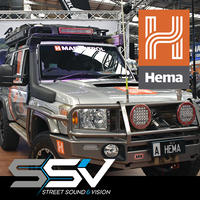
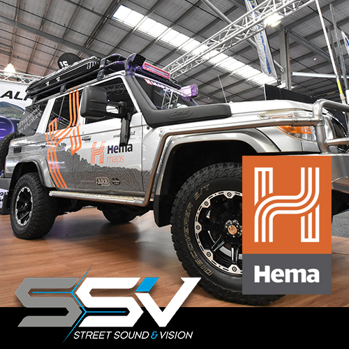
So let's get started on a little bit about who the company HEMA Maps is and what does it do? Hema Maps are a Brisbane based company that has managed to develop a system that can map the harsh outback of Australia. They then use their system to drive it / map it and repeat to report changes and keep their user base up to date and have been doing so for over 30 years. Hema Maps have set the benchmark for recording and reporting rugged terrain, not to mention discovering the various routes vehicles can take across this expansive country. In 1996, Hema Maps expanded to enter the digital world and since then have used GPS to map more than 690,000kms of track and 545,000kms of unsealed roads. The Hema HN-1 was the first device to carry the ever valuable map set, way back in 2007 and has now expanded to a variety of various devices, some provided by Hema themselves and is also available on several of your favourite existing platforms and we will touch on those in a moment.
Let’s take a look at how this technology from Hema can assist. Before you even jump into your vehicle and lock the diff, you need to be planning your trip. A task that Hema Maps can excel in! First up, you can check out the location guides, which outline general guidelines for certain areas in each state. It doesn’t matter if you are off to the Kimberley, Fraser Island or the Grampians National Park, all planning still follows the same guideline for discovering what the trip will entail. Looking at if your vehicle is capable by outlining what surfaces the roads are, the gradients of the hill climbs, how far the petrols stops are apart can all share an important role in how your vehicle performs on its journey. All very important things to ensure you have a great time on your trip, and all of these can be found when planning your journey with Hema Maps.
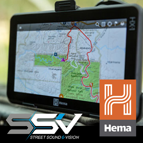
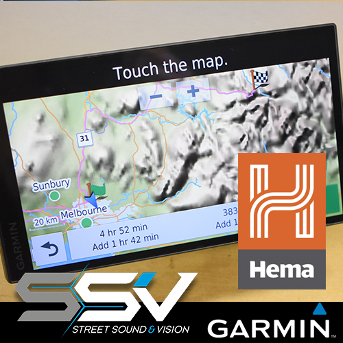
While Hema Maps have a full range of product including the original style paper maps and books, what we are interested here at SSV is the high tech digital stuff like the Hema HX-1 which is a portable navigation which covers the full range of features you would expect! Not only does it offer all the latest 693,000kms of Hema mapped tracks and unsealed roads Australia wide, but it also incorporates a huge range of handy information like detailed site information on over 6000+ free campsite locations and much more. Not only do the great people at Hema even give you FREE LIFETIME off road map updates, but they also include a full supported turn-by-turn Australia wide street mapping for use even if you are just headed down the freeway, or around the corner to the shops! A product that is jammed packed with value. A definite must for the avid 4x4er! Get yours here.
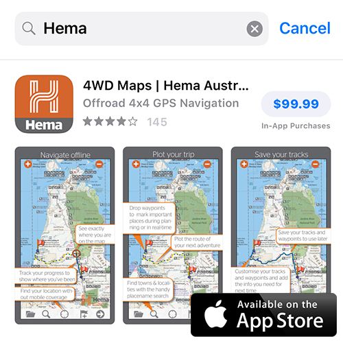
While Hema have their range of own products, they have also allowed their maps to be used with various third party devices. Own an Apple iPhone? No problems, just jump on to the App Store and grab the latest Hema Maps App. You can make it available while offline to make sure you have maps even when you don’t have network coverage. It’s as easy as that to use an existing device to access Hema Maps in a cost effective fashion.
At some point in your life you may have come across the brand Garmin. If you haven’t then that’s ok, because all you need to know to move forward here is that they are the market leaders in portable street navigations devices worldwide (amongst other things!). The newly released Garmin RV 775 MT-S changes that completely, well not completely, because it still offers the same great on road turn by turn instructions that has made the Garmin brand what it is today, but it adds Hema’s full 150k Topographical mapping to it. This can be used by the really serious off roaders as it has the full Hema Maps mapping system incorporated. More suited to the people that would use street maps first, then Off road maps on the weekends, we have the Garmin RV 770 LMT-s which has just a sprinkling of Hema details most notably a full detailed list of POI’s (Points of Interest) including a comprehensive list of campsites, Australia wide.
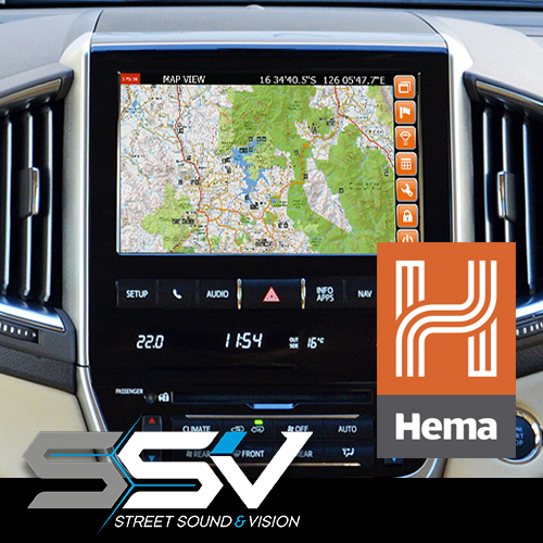
At Street Sound & Vision we look for new and exciting products to help integrate into vehicles. We use the term integration because we want it to be completely seamless, to the point that if somebody was to jump in your vehicle they wouldn’t know that it wasn’t originally supplied by the manufacturer. Our combined love of integration and Hema Maps has resulted in sourcing an aftermarket product that can enable Hema Maps on the original factory screen to suit a various array of vehicles. From imported 4WD from Dodge, Chevrolet and GMC, soft roaders like Toyota Rav4s and Range Rover Evoque, right through to the tough guys like the Jeeps, Landcruisers, Rangers, Ameroks and more. Find out if your car is supported with this aftermarket system here.
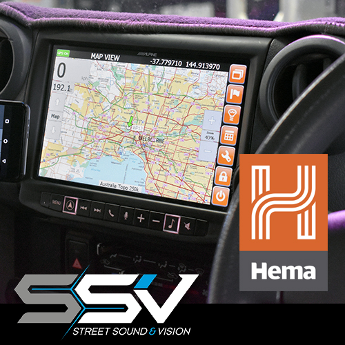
If you unfortunately don’t have an original screen in your car, and a portable navigation does not suit your needs, then fear not as we can provide a solution for you too! Kenwood have an expansion module available for a broad range of their in car multimedia units which can be either retrofitted, or purchased as a package with a Kenwood system to be installed into your vehicle and provide Hema Maps at your fingertips. This will fit almost any car, and again with integration being such a large part of what we do here at SSV we can do so while still maintaining all of your original features of the car including the steering wheel controls, reverse cameras, factory USB points and much more. Check out the Kenwood / Hema Maps range here.
Looking into the future of 4WD Hema topographical mapping there are some great things we can see on the horizon including our close partners Alpine Electronics are getting ready to release their latest generation navigation systems that will feature on there leading capacitive touchscreen in 7”, 8” and even 9” screens, some of the biggest in the aftermarket realm. Stay tuned for more info on that, because from what we have discovered as a universal trait amongst 4WD enthusiast is screen size is paramount! Alpine will hold the key here, no release date has been published yet, but will be chomping at the bit to get our hands on these units and we will scream it from the high heavens when we do!
So what can Hema do for you? It will help you get from point A to point B however you decide to plan your journey and ensure you do it in the safest most enjoyable way. Come in store for your free demonstration and we can show you the Hema Maps difference.

 SSV Street Sound & Vision - Keilor Park Store
 Mail:
Mail: